A difference is not a diagnosis
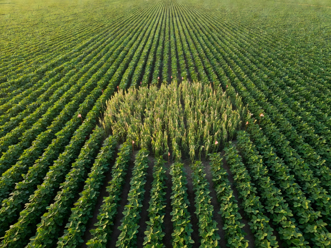
Visible-light cameras can describe canopy cover, gaps and surface appearance. Multispectral instruments can reveal differences in reflected light. Thermal measurements can support investigation of canopy temperature, provided weather and capture conditions are understood. None of these observations, taken alone, establishes the cause of crop stress.
A thin patch might reflect establishment problems, waterlogging, grazing, disease or a previous machinery pass. Soil measurements and field history help narrow those possibilities. Ask what the sensor actually measured before adopting the label attached by a model. “Lower canopy cover” is often a more defensible initial statement than “nutrient deficiency.”
Keep the observation attached to its context
Record capture time, sensor identity, calibration status, coordinate reference system and positioning quality. Include crop stage and relevant weather notes where available. A reading made before rain may be unsuitable for a task planned after the surface has become soft. Even accurate measurements lose value when their context is stripped away.
Satellite observations from the European Space Agency’s Sentinel-2 mission can help place a patch in a wider pattern. They do not automatically provide the freshness or spatial detail needed to navigate a machine between rows. Copernicus data should be treated as an evidence layer, not as a substitute for an up-to-date operating-area survey.
Minimum observation packet
- What was measured, with units where applicable.
- Where and when the measurement was captured.
- Known uncertainty, missing coverage and quality flags.
- The original evidence and the interpretation kept separately.
- A named person or process responsible for the next check.
Position uncertainty changes the next action
A global navigation satellite system, or GNSS, provides an estimated position rather than an unconditional guarantee. Real-time kinematic correction can improve positioning under suitable conditions, but correction loss, obstructions and multipath still matter. Preserve the reported quality state rather than recording every point as equally reliable.
A field map may use a different coordinate reference system from the machine controller. WGS 84 coordinates, local projected grids and farm-specific maps need explicit conversion and checking. The Open Geospatial Consortium’s work on geospatial interfaces provides useful vocabulary, but a compliant interface alone cannot prove that two datasets describe the same physical boundary.
Check across the patch, not just at its centre
A ground check should include the affected area and a useful comparison area. Look for changes at the edge: soil texture, standing water, wheelings and plant development may explain why the signal changes. Record what was checked and what remained inaccessible. A single photograph from the easiest access point can miss the condition that matters.
Training data also has a season. A model developed with one crop, growth stage or lighting pattern may perform differently elsewhere. University research from Wageningen University & Research and Harper Adams University helps illustrate the breadth of agricultural sensing challenges; it should not be read as validation of an unrelated commercial system.
| Layer | Useful for | Check before handoff |
|---|---|---|
| Canopy image | Locating visible variation | Lighting, coverage and capture date |
| Soil reading | Local ground context | Depth, calibration and sampling location |
| Position record | Finding the observation again | Reference system and quality state |
Hand over a question that can be answered
For our example, the appropriate output is an inspection request with a mapped area, supporting observations and stated uncertainty. Do not smuggle a treatment recommendation into the route description. The planner needs to know where a closer look is required; the agronomist needs to know what evidence supports any later intervention.
Retain negative findings too. If the second pass finds no repeatable difference, that is useful evidence rather than a failed mission. It can reveal a transient shadow, a positioning mismatch or a condition that changed between visits. Good monitoring makes these explanations visible instead of rewarding every alert with a machine movement.
Exception note: the patch cannot be located reliably
Keep the observation, flag its positional limitation and request a checked reference before dispatch. Do not compensate by expanding a treatment area without agronomic authorization.
Next: turn evidence into a task
Reference points: European Space Agency, Copernicus, Open Geospatial Consortium, Wageningen University & Research and Harper Adams University. These links provide background, not endorsements.